-40%
234 old maps NORTH CAROLINA state PANORAMIC genealogy lots HISTORY atlas DVD
$ 3.16
- Description
- Size Guide
Description
Rare Map CollectionThis DVD is part of our Historic Map and Atlas Collection.
We have dozens of Atlas maps on DVD and CD ranging from the 1500s to the 1900s covering many areas and topics.
Please Check our Ebay Store for what's available.
FOR MANY MORE EDUCATIONAL CD TITLES
ON THIS AND MANY OTHER SUBJECTS
PLEASE VISIT OUR EBAY STORE
VERY LARGE HIGH RESOLUTION
MAP COLLECTION
ON DVD!!
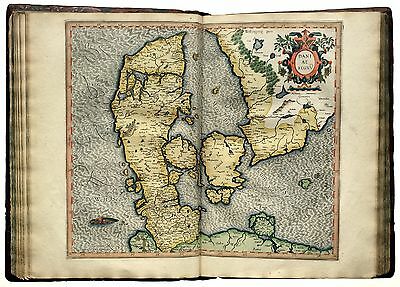
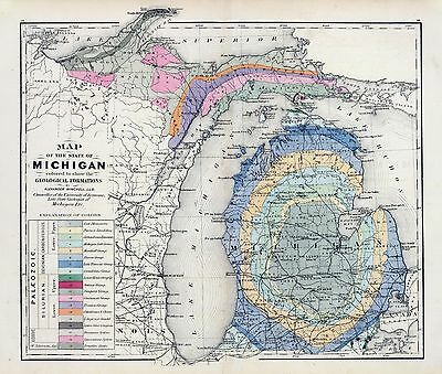
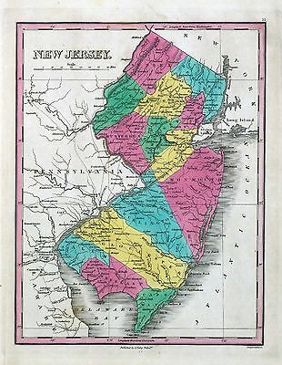
(please see full table of contents and sample illustrations below)
This DVD Contains
234 Maps of
North Carolina
Including
14 PANORAMIC MAPS
of various North Carolina Cities
These are scans of the
ORIGINAL
maps by various Cartographers.
on DVD
System requirements
PC or Mac compatible.
Files are simple PDF files with a basic HTML interface (just like viewing a webpage)
Works with ALL versions of Windows.
Maps of
North Carolina
0028043
(Arrowsmith, Aaron); Lewis, Samuel
1812
North Carolina.
0041009
Asher & Adams
1874
N. & S. Carolina.
0089027
Bradford, Thomas G.
1838
North Carolina.
0104006
Burr, David H., 1803-1875
1839
Map of North And South Carolina.
0122018
Carey, H. C. ; Lea, I.
1822
Map Of North Carolina.
0149032
Colton, G.W.
1856
North Carolina.
0278008
Finley, Anthony
1826
Map Of North and South Carolina And Georgia.
0285019
Finley, Anthony
1831
North Carolina.
0315007
(Grigg, John)
1830
N. & S. Carolina.
0346026
Jefferys, Thomas
1776
Map Of North And South Carolina With Their Indian Frontiers. (Northern Section)
0346028
Jefferys, Thomas
1776
Composite: North & South Carolina.
0537019
Mitchell, Samuel Augustus
1846
New Map Of Nth. Carolina.
0586025
Mitchell, Samuel Augustus
1880
N. & S. Carolina.
0594026
(Mitchell, Samuel Augustus)
1890
N. & S. Carolina.
0632019
Morse, Jedidiah
1794
North Carolina.
0845016
Reid, John ; Winterbotham, W.
1796
State of North Carolina.
0890138
Society for the Diffusion of Useful Knowledge (Great Britain)
1833
N. & S. Carolina.
0977015
Tanner, Henry S.
1836
New Map Of Nth Carolina.
1780075
Schultze, Otto Julian; United States. War Department
1895
Ft. Fisher.
1780142
Julius Bien & Co.; United States. War Department
1895
Gen. map IV.
2212263
Vandermaelen, Philippe, 1795-1869; Delavault, A.
1827
Partie des Etats-Unis. Amer. Sep. 57 bis.
2301024
Morse, Sidney E. (Sidney Edwards), 1794-1871; Breese, Samuel, 1802-1873
1845
North Carolina.
2436048
(Arrowsmith, Aaron); Lewis, Samuel
1804
North Carolina.
2483023
Mitchell, Samuel Augustus
1870
N. & S. Carolina.
2501013
Henshaw, Frances H.
1828
North Carolina.
2542014
Carey, Mathew ; Lewis, Samuel
1795
State of North Carolina.
2755014
Tanner, Henry S.
1825
Map of North & South Carolina.
2862037
Carey, Mathew
1796
State of North Carolina.
2905017
Johnson, A.J.
1860
North And South Carolina.
2915002
(Moore, M. B. (Marinda Branson), 1829-1864)
1863
(N Carolina, S Carolina)
3044000
Colton, J. H.
1863
North Carolina With Part Of Virginia & South Carolina.
3565088
Rand McNally and Company
1897
North Carolina.
3884008
Mitchell, Samuel Augustus
1831
Map of North and South Carolina, and Georgia.
4453029
Goodrich, S.G. ; Bradford, Thomas G.
1841
North Carolina.
4520033
Rand McNally and Company
1879
North And South Carolina.
4577018
Carey, Mathew
1814
North Carolina.
4584058
Lucas, Fielding Jr.
1823
Nth. Carolina.
4628051
Burr, David H., 1803-1875
1835
North And South Carolina.
4807149
Meyer, Joseph, 1796-1856
1845
Nord Carolina.
4850051
Greenleaf, Jeremiah
1840
North And South Carolina.
4863037
Carey, Mathew
1811
North Carolina.
4865016
Carey, Mathew
1796
North Carolina.
4869007
(Morse, Sidney E. (Sidney Edwards), 1794-1871)
1823
N.C., S.C., Georgia.
4966009
(Hinton, John Howard); Hinton, Isaac Taylor, 1799-1847; Simpkin & Marshall.
1832
N. & S. Carolina.
5370005
Cram Atlas Company
1875
North And South Carolina.
5371120
Letts, Son & Co.
1883
E. United States 3.
5388020
Tanner, Henry S.
1823
Map of North & South Carolina.
5580051
Moll, Herman, d. 1732
1736
Carolina.
ar006900
Homann Erben (Firm)
Main Title: America Septentrionalis a Domino d’Anville in Galliis edita nunc in Anglia. Coloniis in interiorem Virginiam deductis nec non Fluvii Ohio cursu aucta notisque geographicis et historicis illustrata et ad bellum praesentis temporis accomodata. Sumptibus Homannianorum Heredum.
Noribergæ, 1777.
ar008300
Homann Erben (Firm)
Main Title: Dominia Anglorum in America Septentrionali. Specialibus mappis Londini primum a Mollio edita, nunc recusa ab Homannianis Hered.
[Norimbergæ, 1759]
ar008301
Homann Erben (Firm)
Main Title: Dominia Anglorum in America Septentrionali. Specialibus mappis Londini primum a Mollio edita, nunc recusa ab Homannianis Hered.
[Norimbergæ, 1759]
ar008303
Homann Erben (Firm)
Main Title: Dominia Anglorum in America Septentrionali. Specialibus mappis Londini primum a Mollio edita, nunc recusa ab Hommanianis Hered.
[Norimbergæ, between 1759 and 1784]
ct000777
White, John, fl. 1585-1593.
Main Title: Americæ pars, nunc Virginia dicta : primum ab Anglis inuenta, sumtibus Dn. Walteri Raleigh, Equestris ordinis Viri, Anno Dn¯i. MDLXXXV regni Vero Sereniss. nostræ Reginæ Elisabethæ XXVII, hujus vero Historia peculiari Libro descripta est, additis etiam Indigenarum Iconibus / autore Ioanne With ; sculptore Theodoro de Bry¨, qui et. excud.
[Francofurtum ad Mænum] : De Bry¨, [1590]
ct001033
Santa Cruz, Alonso de, 1505-1567.
Main Title: [Mapa del Golfo y costa de la Nueva Espan~a : desde el Ri´o de Panuco hasta el cabo de Santa Elena ...].
[1572?]
ct001099
Map of Virginia and West Va., North & part of South Carolina, Maryland & Delaware, showing the situation in these states of schools taught by graduates of the Hampton Normal & Agricultural Institute from 1871 to 1876.
N.Y. : Am. Photo-Lithographic Co., [1876]
cw0008000
Colton, J. H. (Joseph Hutchins), 1800-1893.
Main Title: J. H. Colton’s topographical map of North and South Carolina. A large portion of Georgia & part of adjoining states. Entered according to Act of Congress in the year 1861 by J.H. Colton.
New York Printed by Lang & Laing 1861.
cw0079a60
Nicholson, W. L.
Main Title: Mountain region of North Carolina and Tennessee, compiled by W. L. Nicholson & A. Lindenkohl, with corrections to January 1865. Drawn by A. Lindenkohl. H. Lindenkohl & Chas. G. Krebs, lith.
[S.l.], U.S. Coast Survey, A. D. Bache, Supt., [1865]
cw0093500
United States. Army. Corps of Engineers.
Main Title: Part of the military department of the South, embracing portions of Georgia and South Carolina. Compiled and engraved in the Engineer Bureau, War Department.
[S.l., Engineer Bureau, War Department] 1865.
cw0304500
Bachmann, John.
Main Title: Birds eye view of North and South Carolina and part of Georgia.
[New York, John Bachmann, c1861]
cw0304750
Colton, J. H. (Joseph Hutchins), 1800-1893.
Main Title: Colton’s new topographical map of the eastern portion of the State of North Carolina with part of Virginia & South Carolina from the latest & best authorities.
New York, J. H. Colton, 1861.
cw0305a20
Lindenkohl, A.
Main Title: Coast of North Carolina & Virginia compiled at the Coast Survey Office, Febr. 1862. Drawn by A. Lindenkohl. Lith. by H. Lindenkohl.
[Washington, D.C., U.S. Coast Survey, 1862]
cw0305a30
Lindenkohl, A.
Main Title: Coast of North Carolina & Virginia compiled at the Coast Survey Office, Febr. 1862. [Drawn by A. Lindenkohl. Lith. by H. Lindenkohl.].
[Washington, D.C., U.S. Coast Survey, 1862]
cw0305a40
Lindenkohl, A.
Main Title: North Carolina & South Carolina Drawn by A. Lindenkohl. Chas. G. Krebs, lith.
[S.l.], U.S. Coast Survey, A. D. Bache, Supdt., 1865.
cw0305a50
Lindenkohl, A.
Main Title: [North Carolina Drawn by A. Lindenkohl] H. Lindenkohl & Chas. G. Krebs, lith. U.S. Coast Survey, A. D. Bache, Supdt. 1865.
[Raleigh, State Dept. of Archives and History, 1966]
cw0305a60
Lindenkohl, A.
Main Title: [North Carolina, with adjacent parts of Virginia and South Carolina] Drawn by A. Lindenkohl.
[S.l.], U.S. Coast Survey, A. D. Bache, Supdt., 1865.
cw0305a80
L. Prang & Co.
Main Title: North Carolina coast line. Showing every inlet, sound & bay of special interest, from Fortress Monroe to South Carolina.
Boston, [1862]
cw0306000
United States. Army. Corps of Engineers.
Main Title: Eastern portion of the military department of North Carolina compiled from the best and latest authorities in the Engineer Bureau, War Department, May 1862.
cw0306500
United States Coast Survey.
Main Title: Sketch of the coast of North Carolina from Oregon Inlet to Ocracoke Inlet.
[Washington U.S. Coast Survey], 1861.
cw0306700
United States. Navy
Main Title: Diagram showing the position of the Sassacus and ram Albemarle at the time of collision.
Washington, Government Printing Office, 1864.
cw0307000
Colton, G. Woolworth (George Woolworth), 1827-1901.
Main Title: The war in North Carolina. Map of the entrance to Beaufort harbor, N.C. showing the position of Fort Macon, etc.
[S.l., 1861]
cw0308000
United States Coast Survey.
Main Title: Beaufort harbor, North Carolina. Re-survey in June and July 1862. Corrected up to April 20th 1864 Chas. G. Krebs, lith.
[Washington U.S. Coast Survey, 1864]
cw0309500
United States Coast Survey.
Main Title: Reconnoissance [sic] of Cape Lookout shoals by the party under command of Lieut. Comdr. T. S. Phelps, U.S.N. Assist. Coast Survey. Engd. by W. H. Davis.
[Washington, U.S. Coast Survey], 1864.
cw0309700
United States Coast Survey.
Main Title: Core Sound and Straits, North Carolina.
[Washington, U.S. Coast Survey], 1864.
cw0313000
[Fort Fisher, defensive work protecting the entrance to the port of Wilmington, North Carolina, captured by the Federals, Jan. 15, 1865].
[1865]
cw0316200
United States. Navy.
Main Title: First attack upon Fort Fisher, by the U.S. Navy under Rear Admiral D. D. Porter, Dec. 24 and 25, 1864. Showing the position of vessels and line of fire Bowen & Co., lith., Philada.
[S.l., 1865]
cw0316400
United States. Navy.
Main Title: Second attack upon Fort Fisher by the U.S. Navy under Rear Admiral D. D. Porter, Jan 13, 14, 15, 1865. Showing the position of vessels and line of fire. Bowen & Co., lith., Philada.
[S.l., 1865]
cw0316500
Foster, John G. (John Gray), 1823-1874.
Main Title: Sketch showing route pursued in the advance to Goldsboro, N.C., in Dec. 1862 Bowen & Co., lith., Phila.
[S.l., 1866]
cw0316700
United States Coast Survey.
Main Title: Preliminary chart of Hatteras Inlet, North Carolina From a trigonometrical survey under the direction of A. D. Bache, Superintendent of the survey of the coast of the United States. Triangulation by A. S. Wadsworth, Asst. Coast Survey. Hydrography by the party under the command of Lieut. Comdg. T. S. Phelps, U.S.N., Asst. Coast Survey, Bowen & Co. lith. Phila.
[Washington, U.S. Coast Survey], 1862.
cw0316800
Foster, John G. (John Gray), 1823-1874.
Main Title: Sketch showing the route to Newbern, pursued by the Burnside expedition, March 13 & 14, 1862 Bowen & Co., lith., Philada.
[Washington, Government Printing Office, 1866]
cw0316900
United States Coast Survey.
Main Title: Oregon Inlet, N. Carolina Triangulation by W. M. Boyce, Assist. Topography by John Mechan, Sub-Assist. Hydrography by Henry Mitchell, Assist. Bowen & Co. lith. Philada.
[Washington, U.S. Coast Survey], 1862.
cw0317100
Foster, John G. (John Gray), 1823-1874.
Main Title: Sketch of Roanoke Island, N.C. [February 8, 1862] Bowen & Co., lith., Phila. [1866].
[Washington, Government Printing Office, 1866]
cw0317120
Foster, John G. (John Gray), 1823-1874.
Main Title: Sketch showing route of the Burnside expedition [to Roanoke Island, N.C., February 6, 1862] Bowen & Co., lith., Phila.
[Washington, Government Printing Office, 1866]
cw0317200
Map of Roanoke Island. [February 8, 1862].
[S.l., 1866]
cw0317300
United States Coast Survey.
Main Title: Mouths of Roanoke River, North Carolina Triangulation and topography by R. E. Halter, Sub-Assist. Hydrography by J. S. Bradford, Sub-Assist. acting under orders of Actg. Rear Admiral S. P. Lee, U.S. Navy, Comdg. North Atlantic Blockading Squadron.
[Washington, U.S. Coast Survey], 1864.
cw0317350
Kraus, C. A.
Main Title: Bird’s eye view of Confederate prison pen at Salisbury, N.C., taken in 1864.
Boston ; New York : J.H. Bufford’s Sons Lith., c1886.
cw0317700
Turner, L. C.
Main Title: Map showing the entrenchments around Wilmington / surveyed & mapped under the direction of Capt. W. H. James, Prov. Engrs., by L. C. Turner, C.E.
1863.
cw0317800
United States Coast Survey.
Main Title: Part of North Carolina showing approaches to Wilmington Compiled at the U.S. Coast Survey Office, March 1864.
cw0476000
Worret, Ch.
Main Title: S.E. portion of Virginia and N.E. portion of N’th Carolina / drawn b. Serg’t Ch. Worret ; & compiled under the direction of Col. T.J. Cram, Chief Top’l Eng’r Dep’t Va.
[186-]
cw0508400
Lindenkohl, A.
Main Title: [Southern Virginia and northern North Carolina] Drawn by A. Lindenkohl. H. Lindenkohl & Chas. G. Krebs, lith.
[S.l.], U.S. Coast Survey, A.D. Bache, Supdt., 1865.
la000585
Yoder, R. A. (Robert Anderson)
Main Title: Map of Catawba County, North Carolina.
[S.l.], 1886.
np000148
Bowen, Emanuel, d. 1767.
Main Title: A new & accurate map of the provinces of North & South Carolina, Georgia &c. Drawn from late surveys and regulated by astronl. observatns. By Eman. Bowen.
[London, 1752]
np000149
Reid, John, publisher.
Main Title: A map of the Tennessee government, formerly part of North Carolina.
[S.l., 1795]
np000150
Carey, Mathew, 1760-1839.
Main Title: North Carolina.
[S.l.], 1814
np000152
Johnson & Browning.
Main Title: Johnson’s North and South Carolina.
[S.l.], 1861.
np000153
Nickolson, W. L.
Main Title: Mountain region of North Carolina and Tennessee.
[S.l.], 1864.
np000158
Geological Survey (U.S.)
Main Title: Tennessee-North Carolina.
[S.l.], 1895-
np000160
North Carolina.
Nantalah
Geological Survey (U.S.)
[Washington, D.C.], 1885-
np000161
North Carolina.
Nantalah
Geological Survey (U.S.)
[Washington, D.C.], 1885-
np000164
North Carolina.
Cowee
Geological Survey (U.S.)
[Washington, D.C.], 1885-
np000165
North Carolina.
Cowee
Geological Survey (U.S.)
[Washington, D.C.], 1885-
np000167
United States. Forest Service. Southern Region.
Main Title: Forest conditions of western North Carolina.
[S.l.], 1909.
np000168
Southern Railway (U.S.)
Main Title: Land of the sky.
[S.l.], 1917.
np000169
Southern Railway (U.S.)
Main Title: Land of the sky.
[S.l.], 1917.
np000170
Southern Railway (U.S.)
Main Title: Land of the sky.
[S.l.], 1917.
np000172
Geological Survey (U.S.)
Main Title: Proposed Great Smoky Mountains National Park, North Carolina-Tennessee.
[S.l.], 1926.
np000188
North Carolina.
Geological Survey (U.S.)
Tapoco
[Washington, D.C.], 1935-
np000189
North Carolina.
Geological Survey (U.S.)
Tapoco
[Washington, D.C.], 1935-
np000194
North Carolina.
Geological Survey (U.S.)
Fontana
[Washington, D.C.], 1935-
np000195
North Carolina.
Geological Survey (U.S.)
Fontana
[Washington, D.C.], 1935-
np000196
North Carolina.
Geological Survey (U.S.)
Fontana
[Washington, D.C.], 1935-
np000197
North Carolina.
Geological Survey (U.S.)
Fontana
[Washington, D.C.], 1935-
np000201
vNorth Carolina.
Geological Survey (U.S.)
Thunderhead Mountain
[Washington, D.C.], 1935-
np000202
North Carolina.
Geological Survey (U.S.)
Proctor
[Washington, D.C.], 1935-
np000203
North Carolina.
Geological Survey (U.S.)
Proctor
[Washington, D.C.], 1935-
np000208
North Carolina.
Geological Survey (U.S.)
Silers Bald
[Washington, D.C.], 1935-
np000214
North Carolina.
Geological Survey (U.S.)
Clingmans Dome
[Washington, D.C.], 1935-
np000215
North Carolina.
Geological Survey (U.S.)
Bryson
[Washington, D.C.], 1935-
np000216
North Carolina.
Geological Survey (U.S.)
Bryson
[Washington, D.C.], 1935-
np000217
North Carolina.
Geological Survey (U.S.)
Bryson City
[Washington, D.C.], 1935-
np000223
North Carolina.
Geological Survey (U.S.)
Whittier
[Washington, D.C.], 1935-
np000224
North Carolina.
Geological Survey (U.S.)
Whittier
[Washington, D.C.], 1935-
np000228
North Carolina.
Geological Survey (U.S.)
Luftee Knob
[Washington, D.C.], 1935-
np000229
North Carolina.
Geological Survey (U.S.)
Bunches Bald
[Washington, D.C.], 1935-
np000232
North Carolina.
Geological Survey (U.S.)
Cove Creek
[Washington, D.C.], 1935-
np000234
North Carolina.
Geological Survey (U.S.)
Dellwood
[Washington, D.C.], 1935-
np000235
North Carolina.
Geological Survey (U.S.)
Dellwood
[Washington, D.C.], 1935-
np000238
North Carolina.
Geological Survey (U.S.)
Dellwood
[Washington, D.C.], 1935-
np000241
United States. National Park Service.
Main Title: Preliminary base map, Great Smoky Mountains National Park.
[S.l.], 1934.
np000253
United States. National Park Service.
Main Title: Great Smoky Mountains National Park, North Carolina/Tennessee, trail map / U.S. Department of the Interior, National Park Service.
Edition Information: Revision A, Spring 1988 ed.
Washington, D.C. : The Service, [1988]
pm006580
Ruger & Stoner.
Main Title: 1891 bird’s-eye view of the city of Asheville, North Carolina. Burleigh Lithographing Establishment.
Madison, Wis. [1891]
pm006590
Fowler, T. M. (Thaddeus Mortimer), 1842-1922.
Main Title: Asheville, Buncombe Co. N.C. 1912. Drawn by T. M. Fowler. Charles Hart, lithographer.
Passaic, N.J., c1912.
pm006600
[Fowler, T. M. (Thaddeus Mortimer)] 1842-1922.
Main Title: Black Mountain, N.C. 1912.
Asheville, N.C., Fowler & Browning, c1912.
pm006610
Ruger & Stoner.
Main Title: Bird’s-eye view of the city of Durham, North Carolina 1891. Burleigh Lithographing Establishment.
Madison, Wis. [1891]
pm006620
Ruger & Stoner.
Main Title: Bird’s eye view of the city of Greensboro, North Carolina. 1891. Burleigh Lithographing Establishment.
Madison, Wis. [1891]
pm006630
[Fowler, T. M. (Thaddeus Mortimer)] 1842-1922.
Main Title: Hendersonville, N.C. 1913.
Asheville, N.C., Fowler & Browning [1913] c1912
pm006640
Downs, A. E. (Albert E.)
Main Title: [Bird’s-eye-view of Hickory, North Carolina. Drawn by A. E. Downs.
Boston?, 1907?]
pm006650
Farris, J. J.
Main Title: Aero view of High Point, North Carolina / by J.J. Farris. Charles Hart Litho.
High Point : [s.n.], c1913.
pm006660
Drie, C. N.
Main Title: Bird’s eye view of the city of Raleigh, North Carolina 1872. Drawn and published by C. Drie.
Raleigh, 1872
pm006670
Fowler, T. M. (Thaddeus Mortimer), 1842-1922.
Main Title: Bird’s eye view of Rocky Mount, North Carolina 1907 / drawn and published by T. M. Fowler, Chas. Hart Photo-litho.
Morrisville, Pa. : [s.n.], c1907.
pm006680
Fowler, T. M. (Thaddeus Mortimer), 1842-1922.
Main Title: Property of the South Rocky Mount Land Co. at South Rocky Mount, N.C. / drawn by T. M. Fowler.
Morrisville, Pa. : [s.n., 19--?]
pm006690
Downs, A. E. (Albert E.)
Main Title: [Bird’s-eye-view of Statesville, North Carolina, by A. E. Downs.
Boston?, 1907?]
pm006700
Fowler, T. M. (Thaddeus Mortimer), 1842-1922.
Main Title: Birds eye view of Wilson, North Carolina 1908. Drawn and published by T. M. Fowler.
Morrisville, Pa., c1908.
pm006710
Ruger & Stoner.
Main Title: Bird’s-eye view of the twin cities, Winston-Salem, North Carolina 1891.
Madison, Wis. [1891]
rr000020
Lay, Amos, 1765-1851.
Main Title: Map of the United States compiled from the latest and most accurate surveys by Amos Lay, geographer & map publisher, New York.
London, 1834.
rr002730
Burr, David H., 1803-1875.
Main Title: Map of North and South Carolina exhibiting the post offices post roads, canals, rail roads &c. By David H. Burr; (Late topographer to the Post Office.) Geographer to the House of Representatives of the U.S.
[London, 1839]
rr002740
Brown, H. C.
Main Title: Railroad map of North Carolina, 1900, examined and authorized by the North Carolina corporation commission.
Chicago, c1900.
rr003080
Doggett, John, 1809-1852.
Main Title: Railroads in Virginia and part of North Carolina, drawn and engraved for Doggett’s Railroad Guide & Gazetteer.
[n.p., 1848]
rr003170
G.W. & C.B. Colton & Co.
Main Title: Map showing the Albemarle & Pantego Railroad and its connections.
[New York], c1887.
rr004890
G.W. & C.B. Colton & Co.
Main Title: Maps showing the Norfolk, Albermarle & Atlantic Railroad and its connections.
New York, 1891.
0027008
0073011
0102023
0151038
0152037
0165002
0165003
0280008
0300048
0346024
0346025
0352028
0358034
0425091
0462002
0462011
0516002
0523005
0535027
0887012
0887015
0902005
1071004
1550034
1690074
1954077
2054028
2094026
2134070
2307018
2514020
2559008
2589033
2593030
2680022
2721023
2743004
2757001
2782011
2809039
2809040
2809042
2844032
2866051
2931038
3083064
3214002
3471011
3803022
3855000
3888025
4323008
4324019
4328020
4534022
4557018
4574024
4578019
4587037
4727034
4740035
4825036
4835027
4854002
4862020
4864023
4866045
4884032
4977020
5007010
5022028
5026002
5028046
5028051
5028052
5198022
5363019
5479057
5745046
5755010
5784026
5802011
5956027
6323007
6727020
6903044
Features of this DVD
This auction is for a DVD of the maps listed in electronic form,
NOT
the maps themselves.
These maps are VERY high resolution and can be printed at FULL SCALE or LARGER for framing and display. The results are very high quality and convincing.
Ad and disk copyright 2013
Euriskodata
All Rights Reserved


